Tech-driven solutions for tackling human-wildlife conflict scenarios in the Sundarbans
Inaccessibility is one of the major challenges in Protected Areas (PAs) to tackle any field-level problem, especially in the Sundarbans landscape, which is one of the world’s largest mangrove forests and a critical tiger habitat.
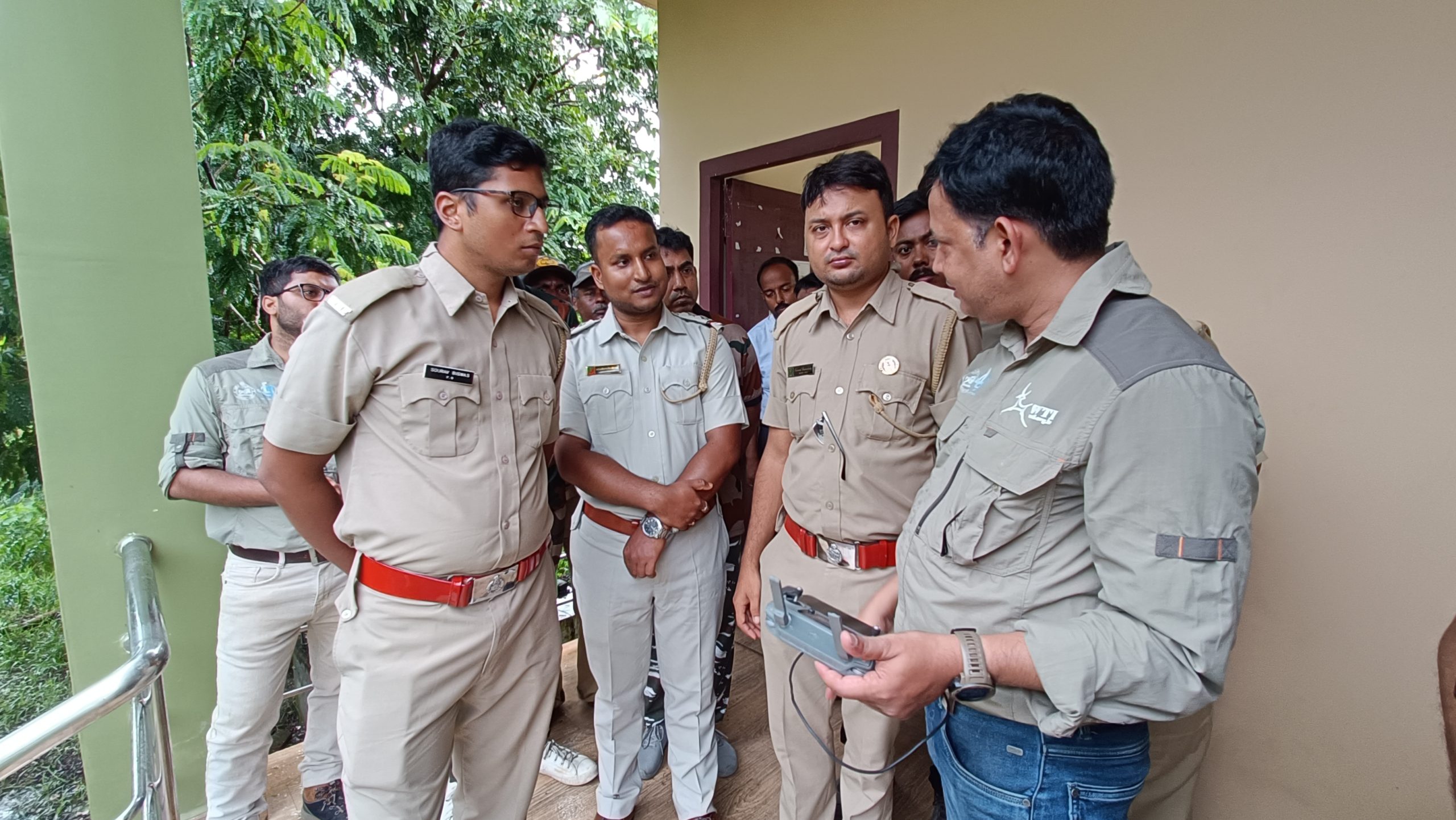
However, recent support from WTI to the 24 Parganas (South) Forest Division under the Sundarbans Tiger Project in the form of a state-of-the-art drone will help enhance their aerial surveillance capabilities.
Rudra P Mahapatra at the drone handling training program at Sundarban Animal Park. Photo by Samrat Paul
Efficient on-site action can only be taken with proper planning for which we must have access to relevant data. The current methods of wildlife data collection are labour-intensive, cost-inefficient, time- consuming and error-prone. Additionally, they pose risks to frontline staff on the field. In comparison, using drones is a more cost-effective and faster approach. They can be used to monitor wildlife populations, track migrations, observe habitat health and changes over time, and more. In short, drones are immensely helpful tools for almost every aspect of wildlife conservation, making them quite common in wildlife conservation and habitat management efforts.
The drone was officially handed over to the forest department during the celebration of ‘International Tiger Day’ on 29th July 2023 to enhance the management of tiger straying cases or more broadly, to improve Human-Tiger Conflict (HTC) mitigation efforts situations. The drone will aid the forest department in pinpointing the location of the tigers or any stray animals through aerial surveillance. In previous years, there have been several cases where tigers entered paddy fields or forest patches near villages, making it difficult and dangerous for ground staff to ascertain their location. Consequently, this delayed the entire rescue process.
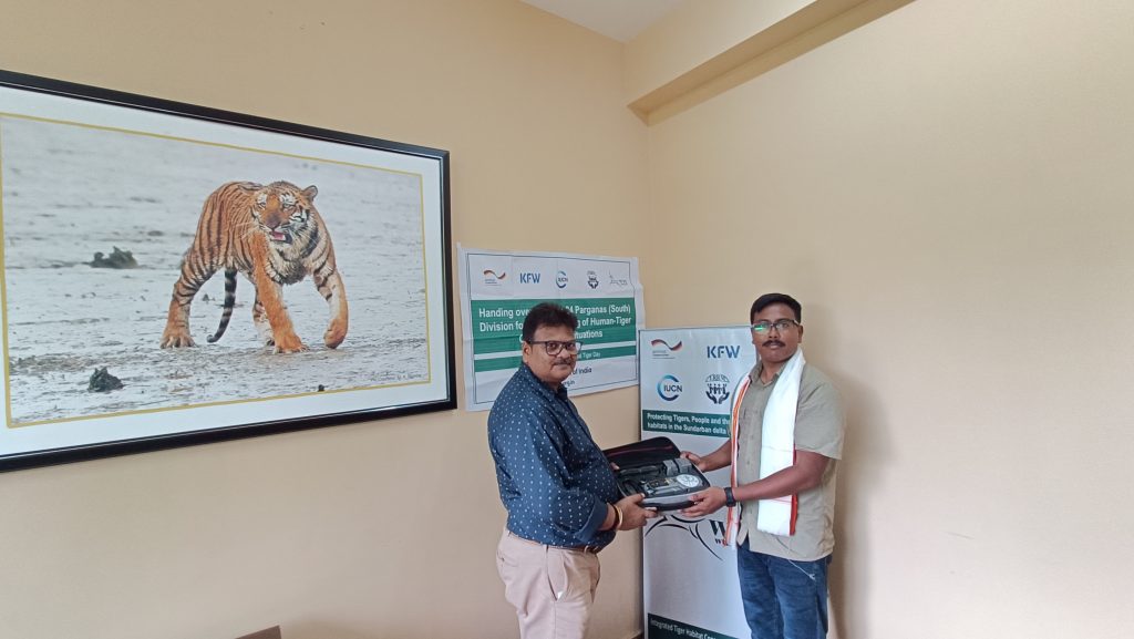
Officially handing over the drone to the forest department. Photo by Samrat Paul
Divisional Forest Officer of the 24 Pargana (South) Forest Division Mr. Milan Kanti Mondol expressed that the drone is instrumental in locating wild animals that have ventured into human habitats as well as identifying breaches in the nylon net installed in the landscape”. These drones are designed to be user-friendly and lightweight, allowing them to fly at very low heights which helps to accurately pinpoint the location of any stray wild animals. This enables e quick decision-making, saving valuable time and expediting conflict resolution efforts.
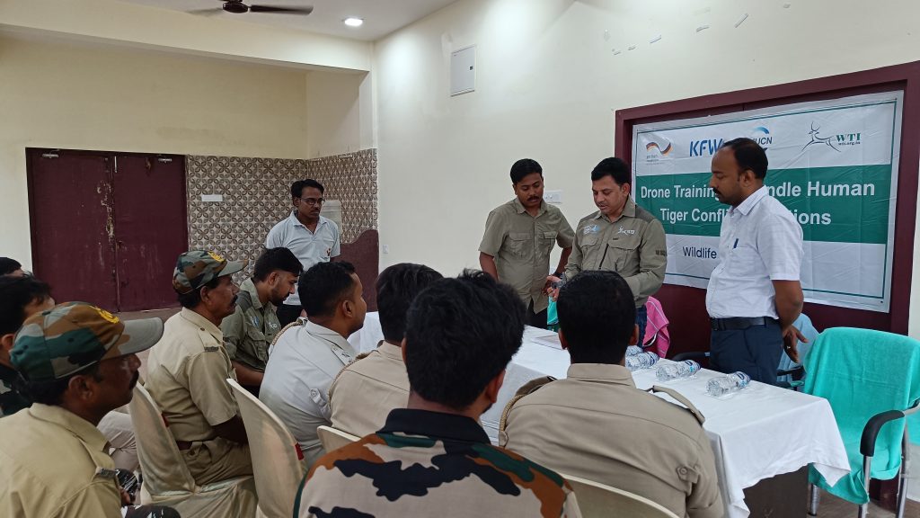
Our team conducted a drone handling training program at Sundarban Animal Park, Jharkhali which was attended by frontline staff from Matla, Raidighi and Ramganga Ranges. Rudra P Mahapatra, Project Head, Odisha-WTI, imparted training on the basics of drone handling and operating guidelines. He added, “We’ve been using drones in Keonjhar and Simlipal forest of Odisha for the last 8-9 years for management of human-elephant conflict (HWC), monitoring wild animal movement and in anti-poaching activities”.
“This drone will aid the 24 Parganas (South) Division in better aerial monitoring of tiger stray incidents when higher risks are involved in ground monitoring due to the tiger’s stressed condition. With low flying capability, this drone will help the frontline staff to accurately locate tigers or any stray wildlife, and assess their health and other important factors. Based on such information, the staff can plan and respond to human-tiger conflict situations more effectively without minimizing potential risks” said Prosenjit Sheel, Project Head/Office-In-Charge, Sundarban Project. Apart from human-wildlife conflict (HWC) management, drones can be used to keep a vigilant eye over forest areas where poaching and illegal hunting are rampant, especially in the case of illegal entry of boats into the forest.
According to the human-wildlife conflict (HWC) survey report conducted by WTI in 2019, Gosaba block had the highest number of tiger conflict cases followed by Kultali. WTI has been actively working in this landscape to reduce human-tiger conflicts and we believe that the deployment of this drone will significantly help in achieving this objective. WTI is currently operating the Sundarban Tiger Project in the Kultali region under 24 Parganas (South) Division Forest in order to reduce human-tiger conflict (HTC) under the IUCN’s Integrated Tiger Habitat Conservation Program (ITHCP)-Phase-II.